Week 13's lab introduced georeferencing which allows users to take a non-spatial referenced raster and have it line up with features. By doing this, it gives the raster a spatial reference. Also learned to create a multi ring buffer and the editor toolbar. Another piece of the lab was learning to use ArcScene. In ArcScene, user is able to create a 3D map and learn how to adjust the layers.
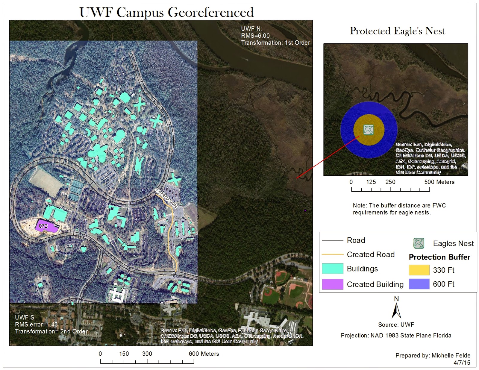
The first map I created using the georeferencing tool. To do this, I had to pick points on the raster image and match the location on the vector polygon. One key thing was keeping a low RMS error and making sure the placement looked accurate. Some polygons and lines were missing, so I used the editor toolbar to create new features. To show the protection shown of the eagle's next, had to create a multi ring buffer.
The second map I created, used the building layer in ArcScene. In ArcScene, I was able to show the buildings in 3D. There are quite a few things to adjust in ArcScene, like base height and vertical exaggeration. This map shows the UWF campus buildings, in 3D with the roads called out.

Michelle, I really like your unique map layout. No overlapping, easy feature distinct, but easy to find how everything fits together in the bigger landscape. Creative! I couldn't really figure out a great layout for it, but now that I see everyone else's there are lots of good ideas. I think yours worked well. Cheers, Alicia
ReplyDelete